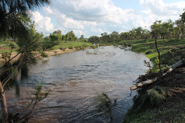
The Condamine River in Warwick continues to subside after almost reaching the ‘minor’ flood level earlier today, Sunday 9 February.
The region is rejoicing after heavy rainfall over the last 48 hours, with national weather watchers Higgins Storm Chasing suggesting Warwick itself received its highest one-day rainfall in 28 years – at 105mm in the 24 hours to 9am today.
Either way Leslie Dam continues to receive a strong inflow with the latest SunWater reading putting the dam at just under 14,000 megalitres (ML).
While the Stanthorpe area also received good falls a Southern Downs Regional Council spokeswoman told the Free Times earlier today only around 40ML flowed into Storm King Dam across the weekend, meaning water carting from Connolly Dam in Warwick will continue indefinitely.
The council spokeswoman said the current urban household water usage target for the region of 80 litres per person per day would be “assessed” in the coming days but did not indicate any relaxation would be made at this time.
The Condamine River at the O.O. Madsen Bridge in Warwick rose to around 2.3 metres below the bridge by around midday today but has since subsided.
The Bureau of Meteorology is forecasting showers and possible storms tomorrow, Monday 10 February and into Tuesday and Wednesday for both the Warwick and Stanthorpe areas.
FOR THE LATEST ROAD CLOSURE UPDATES CHECK THE SOTHERN DOWNS REGIONAL COUNCIL WEBSITE AND FACEBOOK AND CALL THE TRANSPORT AND MAIN ROADS TRAFFIC INFO LINE ON 13 19 40.


